Walluval's BingBong! Presents
Cloud Formations
Dedicated to Norma Jean Sandrovich, who is continuously in awe of the Creator's Glorious Sky!
All photos and info borrowed from the PSC Meteorology Program Cloud Boutique. Photos were taken near Plymouth, NH.
Most clouds owe their existence to upward vertical motion of air, hence they are often associated with weather producing phenomena, such as fronts, troughs, and low pressure systems. However, topography can also help move air upwards and produce clouds.
Cloud Descriptions and Pictures
Pictures are small to save space. To see a full screen photo simply CLICK ON THE PHOTO TO ENLARGE. After viewing, hit your back button to return here.
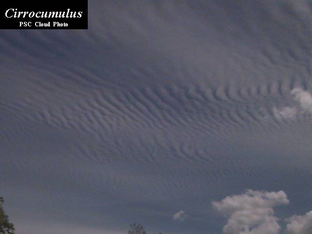
High Clouds are primarily composed of ice crystals.
Cirrus: High altitude wispy clouds.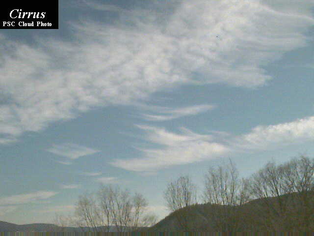
Cirrocumulus: High altitude that have a distinct patchy or wavelike appearance.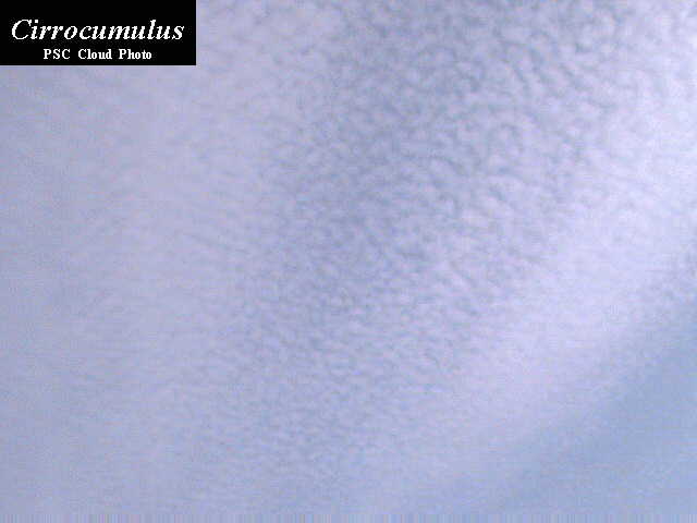
Cirrostratus: High clouds that usually blanket
the sky in sheets. These clouds are usually thin
and the sun and moon shine some light through.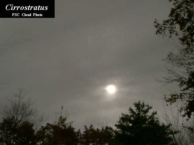
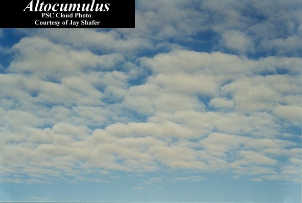
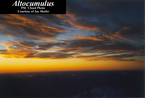
Middle Clouds have many similarities to high clouds. Since they are closer to a ground-based observer, the element appear larger than their high cloud counterparts. They can contain ice crystals and/or water droplets and may occasionally be associated with some light precipitation.
Altocumulus: Are either in a patchy, scattered distribution or can appear in linear bands.
Altostratus: Have a more uniform and diffuse coverage.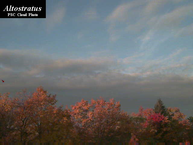
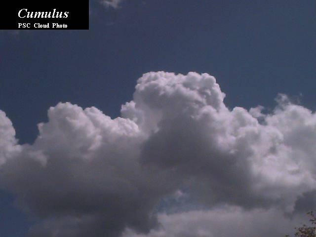
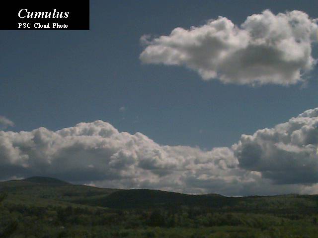
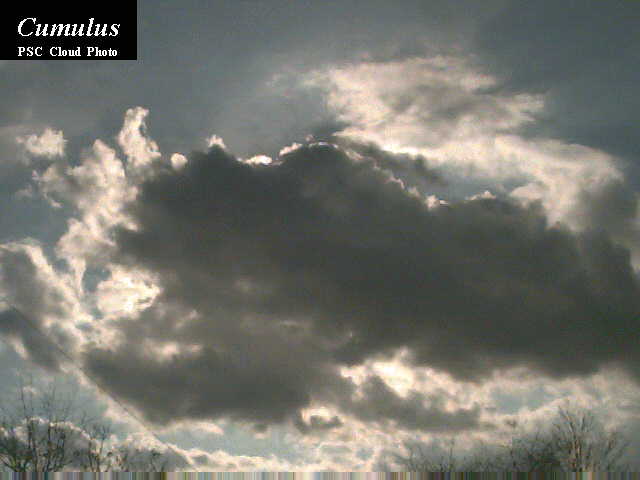
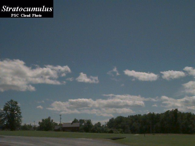
Low Clouds are most often composed of water droplets, but can have ice crystals in colder climates. Some of these clouds can develop into the multi-level clouds.
Cumulus: Are usually puffy and often have very distinct edges and usually a noticeable vertical development. They often have a
poporn-like appearance. They can be isolated or they can be grouped together in clusters.
Stratocumulus: Can be widely scattered but are usually concentrated closer together in clusters and have very little vertical development.

Stratus: Are usually the lowest of the low clouds. Stratus often appear as an overcast deck, but can be scattered.

Fog: Can be considered as a low stratus cloud in contact with the ground. When the fog lifts, it usually becomes true stratus.
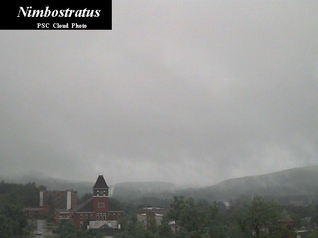
Multi-Layer Clouds are the heavy precipitation producers. The depth of these clouds give precipitation hydrometeors a better environment to develop and grow.
Nimbostratus: Are considered multi-layer clouds because their vertical extent often goes well into the middle cloud region and these
clouds often have even taller cumulonimbus clouds embedded within them. The clouds are very dark, usually overcast, and are associated with large
areas of continuous precipitation. If it's a gray and rainy day, the sky most will most likely be filled with nimbostratus clouds.
Cumulonimbus: Are the clouds that can produce lightning, thunder, heavy rains, hail, strong winds, and tornadoes. They are the tallest of
all clouds that can span all cloud layers and extend above 60,000 feet. They usually have large anvil-shaped tops which form because of the stronger winds at those higher levels of the atmosphere.

Mammatus: Sometimes, strong cumulonimbus
clouds can have appendages protruding from the base of the cloud, which are called mammatus clouds because they resemble the mammary glands of mammals. They indicate that the atmosphere
is quite unstable and can also be an indicator of impending severe weather.

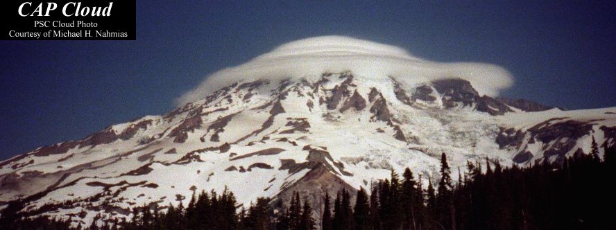
Orographic Clouds are produced by the flow of air interacting with mountainous terrain.
Cap clouds: Form when air containing water vapor is uplifted on the windward slide of the slope and reaches saturation. (photo is of the summit of Mt. Ranier.)
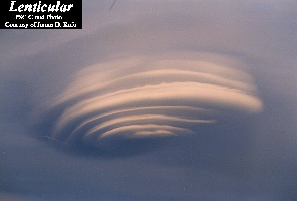
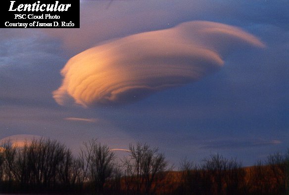
Lenticular: Are lens-shaped clouds that can
result from strong wind flow over rugged terrain. Sometimes they stack up like pancakes in multiple layers. They sometimes are very round and the edges are so well defined that they resemble flying saucers.
Specialty Clouds
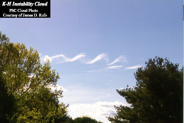
A K-H Cloud: is one that can develop due to Kelvin-Helmholtz (K-H) instability waves and subharmonic resonance with other waves in the
atmosphere. This can result in an intertwined or spiral cloud pattern.
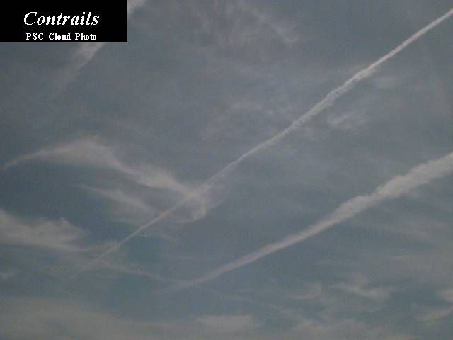
Contrails: formed from the vapor contained in the
exhaust of a jet engine of an airplane when they are flying at high enough altitudes where cold temperatures cause the vapor to turn into ice crystals.
Now you can enjoy the sky even more by spotting all the different kinds of clouds -- who knew?!
| Back to Walluval's BingBong! |